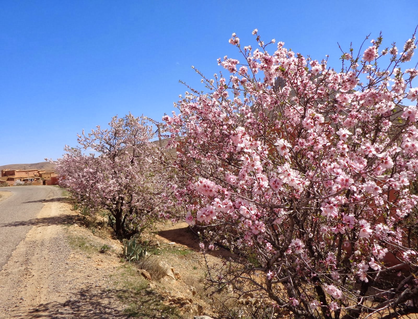
Most of the blossom is white but the odd tree, maybe one in twenty or thirty, is pink, often with cherry red eyes. Only rarely are they planted together in a semblance of an orchard but usually dotted about in wheat fields or around houses.
A diarised guide to life in Taroudant in pictures and English. Some of the items of most interest to general Tourists may be in older posts.
Wednesday, 26 February 2014
Almond Blossom in the Anti-Atlas
Sunday, 23 February 2014
Corrections to my Geology
I've been getting a bit confused about the geology of the mountains and some of the information is in very technical language, so here's what I now understand to be the case in a perfect idiot's guide. (The idiot being me, not you, dear reader.)
The underlying rock of Africa was laid down in Pre-Cambrian times ie. 4500-550 million years This is the granite/quartzite base rock. In Cambrian times the area was a sea. This is also the period when most types of animals with hard parts started to evolve and life forms became much more diverse, known as the Cambrian Explosion and accounting for the fossils.
Then in the Jurassic period ( 200-145 million years ago) there was folding of the baserock uplifting the underlying earth's crust and in the Cretaceous period (145-65 million years ago) there was further crumping of the crust. This was caused by clashing of the techtonic plates of Gondawanaland, from which Africa evolved and Euramerica. This caused the base rock to extrude into the sedimentary rock covering it and produced the mountain ranges. The Atlas which seem to be later than the Anti-atlas were at one time higher than the Himalyas are now. Then erosion gets to work stripping off the softer sedimentary roks and leaving the columns of granite in a process similar to stack formation..The antiatlas was formed in the same plate clashes as the Appalachians so geologically speaking they are sort of cousins,
Saturday, 22 February 2014
Ammelne and the Pink Mountain
Ammelne is the village that has most moved towards western tourism. This is partly because of it's situation just under the Djerbal el Kest. This mountain which is the highest in the area offers, on a clear day, views from the summit to the Atlas, the Sahara, and the Atlantic. It can be walked up but also has a number of good climbing routes.
There is an excellent website for trekkers climbers to the area at
http://www.climb-tafraout.com/ .
Ammelne, 4km out of Tafroute has some guesthouses and a hotel/campsite for those who don't want to pay for taxis and want a minimal walk-up.
The mountains are made of quartzite and granite and the mountain glows pink at sunrise and sunset. One of the guest houses calls itself the "Djerbal Rose" after the mountain.
We stayed at the hotel which had small simple rooms with immaculate en-suite shower rooms, lots of hot water and heating as well as air conditioning. At under £30 halfboard for us both it was a bit of a steal. It had an attractive roof terrace for breakfast with views all round the valley.
Wednesday, 19 February 2014
The Ameln Valley
The Ameln valley, of which Tafroute is the administrative centre, is a long wide valley in the middle of the Anti-Atlas mountains. The area was originally a sea, which accounts for the large number of fossils, and the rock appears to have been formed by layer after layer of silt deposits. In prehistoric times it was covered with tropical savannah and there are ancient rock carvings of elephants and giraffe which we have not yet visited.
The mountains are tall towers of granite and quartzite showing patterns similar to SE USA and familiar from countless westerns. Madre, who knows these things, says it is caused by wind erosion. The upper rock is permeable but there must be an impermeable layer about 200' above the valley floor, shale maybe, because there are a series of springs and, just below the spring line, a string of villages, the traditional habitations before the coming of the French. These are linked by a series of pistes. Madre says there is a similar village pattern along the spring line in the Downs.
The metalled road goes down the centre of the valley with pistes off on each side to the various villages.

The anti-atlas has not been able to support its population to any sort of modern standard for some time and there is a tradition of young men going to work in europe or the cities and only return for a month over Eid. Their families farm in the traditional manner but are maintained by the old and women. The emmigrants retire home with wealth from abroad and send remittances to their families. The result is that these are used to build huge mansions and houses which are affected by the european experience in that a lot of them are termed villas and face outwards towards their plot and the view rather than inwards like a traditional moroccan dwelling. Quite a number of these are being built next the road on the valley floor.
The upshot of this is that there is great tourist potential for europeans. There are great rock -climbing opportunites on the cliff-like mountains over the valley, and the Hotel des Amandiers in town maintains a "new route" book, but also easy walks for the less athletic on the valley floor or the pistes linking the villages. You can either be dropped off by taxi in one village and picked up from another later, a walk with no real ascent, or, you can park by the road, walk up a piste to a village with a slight but minimal ascent, walk along the piste and then down to the road at another village and circle back to the car along the road, which has very little traffic. The routes can be as short or long as you like, have spectacular scenery, and an interesting look into Berber culture. Many french pensioners were taking advantage and the snowbird campervan count was high.
This is encouraged by a deliberate policy to develop tourism so that young men can stay in the valley and not leave. There are a growing number of Chambre D'Hotes particularly in the villages closest to Tafroute. As the valley floor is flat and there are a large number of good pistes cycling is a real possibility too.
Monday, 17 February 2014
The Painted Rocks
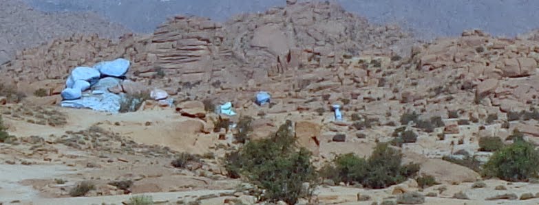
Perhaps its most famous attraction is the painted rocks. These were spray painted by a Belgian artist,Jean Verame, in 1984. They had faded badly and we had never ventured out. Since we were last there they had been re-painted and the piste to see them improved so off we went.
To understand them you need to understand the landscape which is arid semi-desert between the valley walls of the red anti-atlas. The valley floor is studded with huge boulders scattered about.
Some of those boulders have been sprayed pink or blue, and the scale is the key here as they are each about 10m high.. I think they have been designed to be seen from a distance in the landscape rather than close up and as the re-painting has brought out the graffiti artists I think this is where you best see the artists intention. When they were re-painted it was as part of a project that also painted some rocks in part of Arizona which has a similar landscape. Maybe I'll get to see them some time.
Sunday, 16 February 2014
The Road of Ksars
The Ait Baha - Tafroute road is lined with rocky outcrops, many having fortified villages, or Ksars, on top. Some are still inhabited and some are crumbling to nothing as piste returns to the earth of which it is made if it is not renewed regularly. The most spectacular Ksar at Tisougane has its Kasbah converted to a hotel although at £35+ for B&B only with shared bathroom we were not tempted. This is just as well as the new "drive" I've been watching them build various times we drove past turned out to be a very long flight of steps.
Friday, 14 February 2014
Monday, 10 February 2014
Snow above the Clouds
We were up and about a little earlier than usual this morning. The view along the ramparts to the Atlas was stunning with snow on the peaks and the cloud hovering below.
The view south across the Wahr wadi wasn't bad either.
The anti -atlas had low clouds too.
The marabout tomb looked good
and even the rubbish tip had flocks of egrets. They were swooping beautifully until I got the camera out when they all settled.
Sunday, 9 February 2014
The Charcoal Burners
Charcoal is an essential for a traditional tajine. You light it somewhat dangerously on the gas hob and the transfer it on a metal tray or shovel to the burner, put you tajine on top and leave it for 2 hours. It's also essential for barbecues and cooking the Eid sacrifice. I have always wondered where it comes from as you rarely see it sold. Coming back from the drive we saw where it is made.
About a dozen km north of the Anti-Atlas we came to an area with two large charcoal producers a little far apart on opposite sides of the road. There was nothing to indicate why this area should site large scale charcoal production. Beloved assumed the wood was brought in from the Anti-Atlas; but why bring it so far ; wouldn't you just take it to the first bit of flat valley floor? I thought it may be connected to the argan forest regeneration, That land had been cleared of trees (there were no trees only scrub) and it was being burned more or less in situ; but why would you regenerate a forest by cutting the trees down?The method is exactly that described in Swallows and Amazons.
The wood is heaped into circular domes, covered with earth, and burnt slowly over a long period of time. The slow burn with limited oxygen produces charcoal rather than ashes.
Subscribe to:
Posts (Atom)


